Statistics and figures

Brijuni in figures

Along the coast of western Istria, there are several groups of islands among which the most interesting, the largest and the most indented is the Brijuni group of 14 islands and islets. The total surface area of the Brijuni National Park is 3,395.00 ha, of which there is 2,651.70 ha of sea, while the surface of the islands is 743.30 ha. The length of all island coastlines amounts to 46.82 km, while the length of the sea border amounts to 22.93 km.
Present day boundaries

Boundaries of the Brijuni National Park

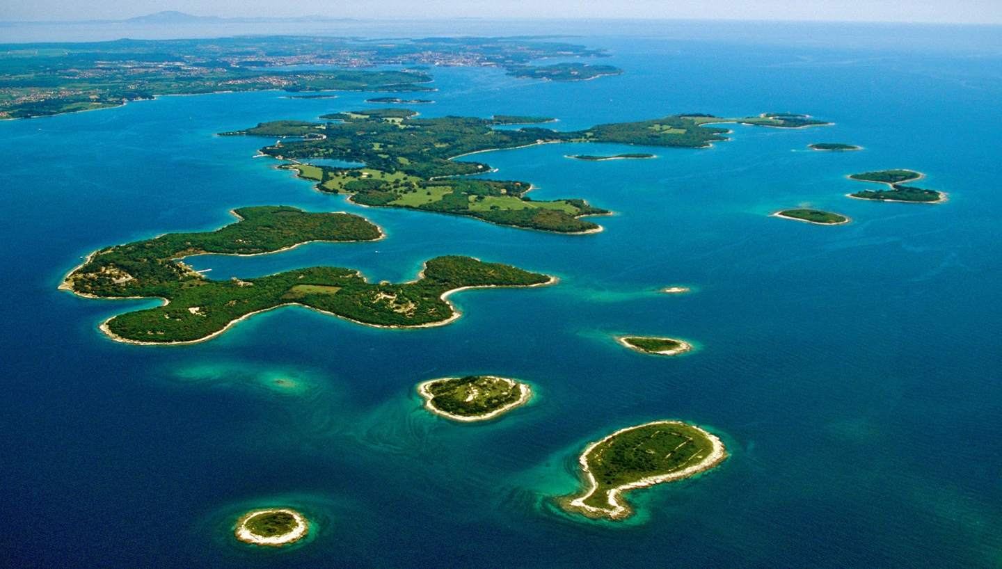
The present day boundaries of the National Park were set in 1999 and comprise the land, the surrounding sea with the seabed and cover an area of 33.9 km2

The length of all island coastlines amounts to 46.8 km. The most indented islands are Veliki Brijun (25.9 km) and Mali Brijun (8.3 km).

The shores are mostly low and rocky but easily accessible due to the horizontal stratification of the rocks, and in some bays gravel and sand can be found. The Brijuni National Park includes 14 islands.

Islands of the National Park

  • Veliki Brijun
  • Mali Brijun
  • Sv. Marko
  • Gaz
  • Okrugljak
  • Supin
  • Supinić
  • Galija
  • Grunj
  • Vanga (Krasnica)
  • Pusti otok (Madona)
  • Vrsar
  • Sv. Jerolim
  • Kozada

From a geological and geomorphological point of view, Brijuni represent a continuation of the western Istria, the so-called “Red Istria”.

Fažana Channel

Depth of the channel is only 12 m

Considering the fact that the Fažana Channel is only 12 m deep, the Brijuni were part of the Istrian mainland ten thousand years ago. Horizontal or slightly inclined layers of limestone dating from the Cretaceous, on which in places there is a relatively thick layer of soil of the brown calcerous type, i.e. terra rossa, are prevalent on the islands. The stone that belongs to this formation is white in color, easily breakable, of marble structure and abundant in clay and silicic acid. It is very solid and represents an excellent construction material. Roman builders appreciated the listed qualities of this stone and it was used to build many towns on the Adriatic coast. 

Average annual temperature of 13.9 °C

Climatically, Brijuni are part of the northern Mediterranean type of climate and have all the qualities of the western Istrian coast with a relatively high value of air humidity (76%). The average annual temperature is 13.9 °C, the annual precipitation average is 817 mm, while the annual average level of insolation is about 2350 hours.

Plenty of sunshine, warmth and humidity

The climate is moderate and Mediterranean

A pleasant climate throughout the year

The climate on Brijuni is moderate and Mediterranean with plenty of sunshine and heat, as well as humidity in the air, enabling the development of lush vegetation and a pleasant stay on the islands. 

In winter, the average temperature is about 6.3 °C, in spring it is 12.2 °C, in the summer 22.2 °C, while in autumn it is 14.8 °C. Sea temperature fluctuates between 22 and 25 °C in summer, while air temperature is about 23 °C.